
Valmeinier Ski Map
The Valmeinier ski map and resort is a charming French ski resort in the Savoie region of the Auvergne-Rhône-Alpes area. Nestled high in the Maurienne Valley of the French Alps, near the Italian border.
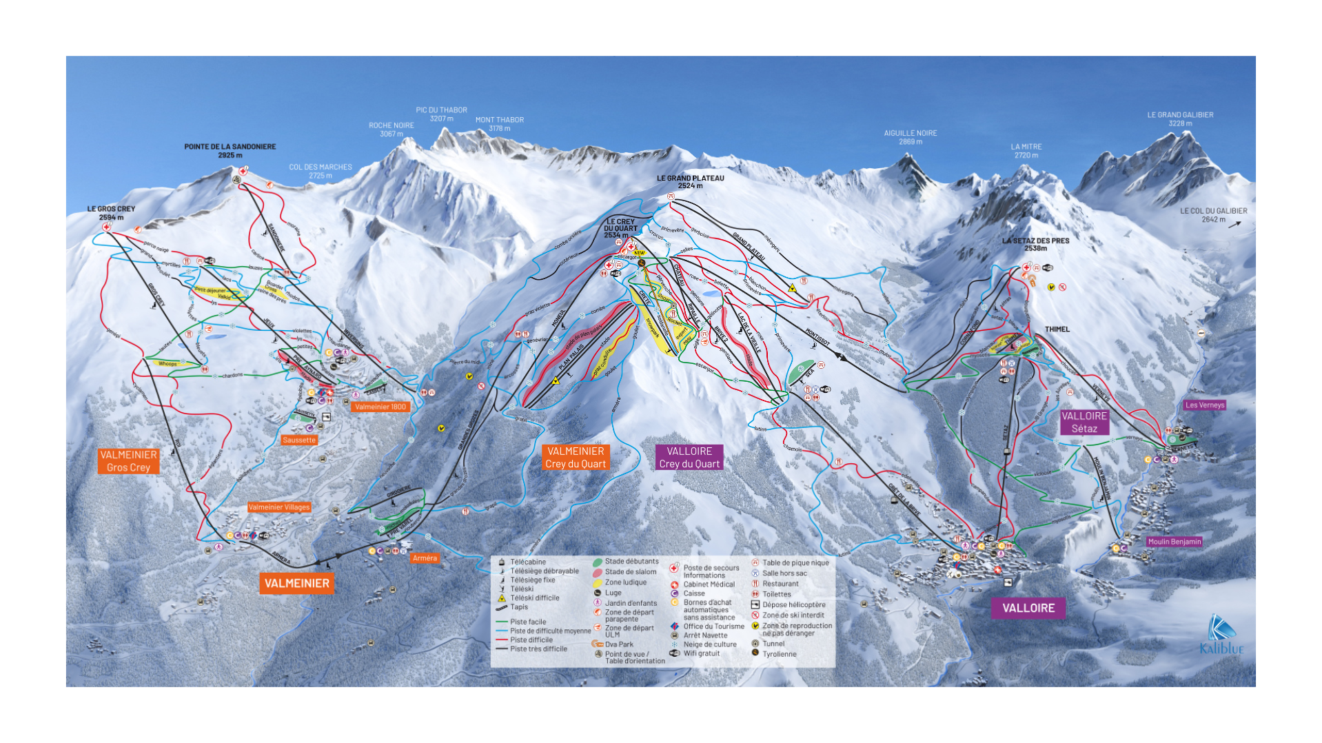
Situated at around 1,500 m (Valmeinier 1500) and 1,800 m (Valmeinier 1800), with skiable terrain up to about 2,750–2,800 metres. With the vast majority of skiing and relatively high altitude, over 2000m. Combined with over 100km of skiable terrain, modern infrastructure make the Valmeinier piste plentiful and enjoyable.
Furthermore, plenty of blue and red runs make the piste of Valmeinier ideal for beginners and intermediates. Although less so experts looking for adventurous black runs. However, freestyle areas, snow parks and off-piste possibilities do provide something for the experts.
Valmeinier piste map and resort has a family-friendly, relaxed atmosphere. Much less crowded than more famous Alpine resorts as many have not heard of the resort. Nor the neighbour Valloire. Valmeinier 1500 provides a more traditional town with stone houses and Alpine character. Whereas slightly higher up you have Valmeinier 1800. A purpose-built resort with modern accommodation, shops, and easy slope access.
Conveniently, a free resort shuttles make it easy to move between the villages and lift areas.
Valmeinier Piste Map Download

Accommodation In Valmeinier
Valmeinier accommodation is varied. That being said, Valmeinier 1500 offer a traditional town feel. Whereas Valmeinier 1800 offers a purpose-built resort with modern accommodation.
Search & book here for all Valmeinier ski accommodation, or package holidays through Erna Low here.