
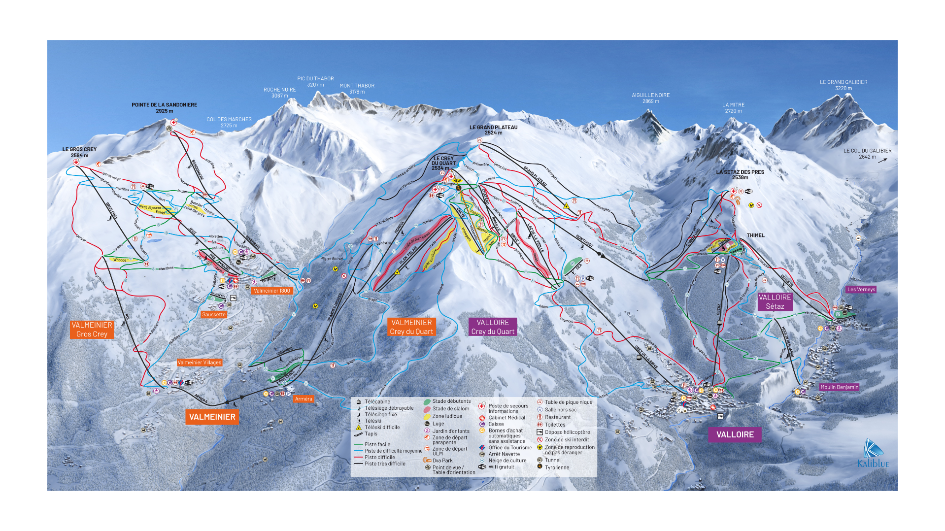
Valloire Ski Map
The Valloire ski map and resort is a charming and authentic ski resort in the French Alps. Located in the Savoie department of the Auvergne-Rhône-Alpes region, set in the Maurienne Valley at the foot of the famous Col du Galibier and Col du Télégraphe.
Part of the Galibier-Thabor ski domain, combining Valloire with nearby Valmeinier. You have over 150 kilometres of slopes catering to all abilities. From green and blue runs for beginners to challenging reds and blacks for more experienced skiers.
Altitudes in the Valloire piste map range from over 1,400 metres to just under 3,000 metres. Impressive heights. Furthermore, a large percentage of pistes are above the 2,000 metres, around 70%. Helping ensure good snow coverage through the season.
A pleasant and low-key resort, focused on local bars and traditional restaurants rather than huge nightclub scenes. Additionally non-ski activities include ice skating, bowling, snowshoeing, dog sledding, and cultural events.
Valloire Piste Map Download
Valloire Ski Map PNG

Accommodation In Valloire
Valloire is seen as a more traditional and village-focused than many large alpine resorts. Picturesque streets centring around a 17th-century Baroque church and predominantly chalet-style buildings. The resort is welcoming and relaxed, with a friendly ambience.
Search & book here for all Valloire ski accommodation, or package holidays through Erna Low here.