
Val d’Allos Ski Map
Val d’Allos ski map and resort is a scenic alpine resort located in the Alpes-de-Haute-Provence region. Found in the south eastern area of France, forming one half of the Espace Lumière ski area, together with Pra Loup. The resort is divided into two villages: Le Seignus and Le Village.
Traditional alpine charm, sunny slopes and family-friendly atmosphere, Val d’Allos offers a quieter and more relaxed alternative to busier French resorts. But provides access to extensive skiing.
The Val d’Allos are reaches heights of an impressive 2,600 metres in altitude. Combined interconnected resorts means approximately 180 kilometres of piste are available to explore too. Varied difficulty, diverse terrain and plenty of runs for everyone. Blue and red slopes for intermediates, green runs towards the base of Val d’Allos. And for those more experienced the occasional black run.
Val d’Allos Piste Map Download
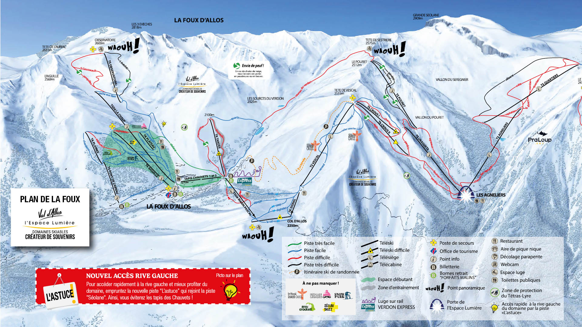
Val d’Allos La Foux Ski Map JPEG

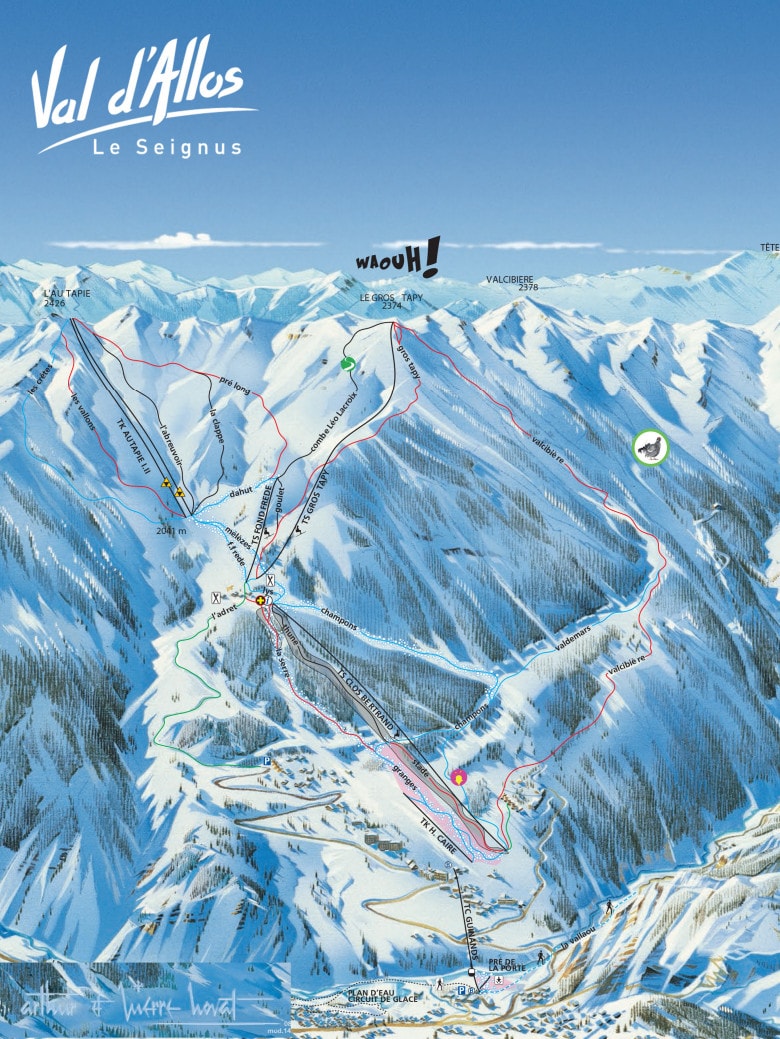
Le Seignus – Val d’Allos Ski Map PNG

Accommodation in Val d’Allos
The Val d’Allos side of Espace Lumiere provides a more traditional alpine charm and laid-back ambiance. This primarily appeals to families and couples and those seeking authenticity. Unlike neighbouring Pra Loup which has a more modern resort feel, with ski-in ski-out hotels, chalets and self-catering apartments for all. and a relatively lively après-ski atmosphere.
Search & book here for Val d’Allos ski accommodation.