
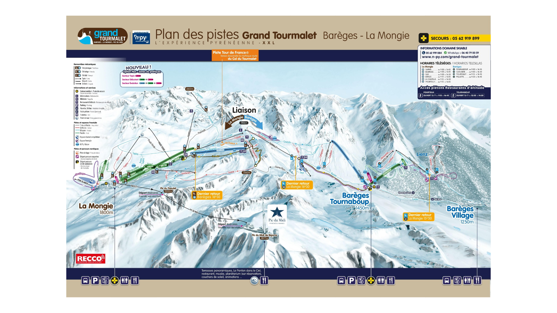
Grand Tourmalet Ski Map
The Grand Tourmalet ski map and resort is located in the French Pyrenees and one of the largest and most varied ski areas in the region. Linking the two ski resorts of Barèges and La Mongie, Grand Tourmalet offers a broad mix of terrain, big-mountain scenery, and a relaxed Pyrenean atmosphere that appeals to beginners, intermediates, and adventurous skiers alike.
Sitting between approximately 1,250m and 2,500m the Grand Tourmalet piste map stretching across both sides of the Col du Tourmalet, famous from the Tour de France. Its dual-village structure means you can choose between the traditional, authentic mountain ambience of Barèges and the more modern, ski-focused La Mongie. All easily accessibly and within the same spacious ski area.
With over 100 kilometres of slop to explore it’s the largest ski domain in the French Pyrenees. Offering a bit of everything for all abilities. From tree runs, open bowls, freeride zones, family-friendly slopes and high-altitude terrain with excellent snow reliability.
High-altitude slopes combined with modern snowmaking offer reliable conditions. While Barèges benefits from a forested microclimate that often preserves good snow when other Pyrenean resorts struggle.
Grand Tourmalet Piste Map Download

Accommodation in Grand Tourmalet
Grand Tourmalet accommodation varies between the two bases. La Mongie provides options of ski-in ski-out apartments, hotels and family residence. Whereas Barèges provides traditional lodgings, cosy guesthouses and chalets.
However, both options offer good access to the slopes with choices for all budgets.
Lastly, search & book here for Grand Tourmalet ski accommodation