
Balme Vallorcine Ski Map
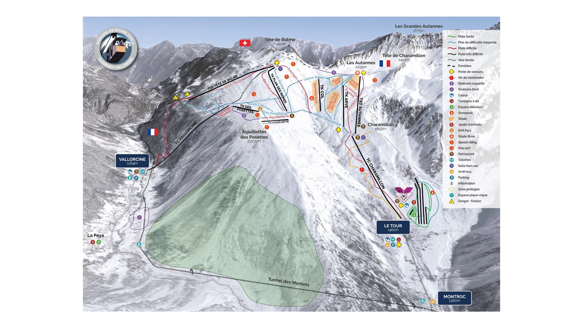
The Balme–Vallorcine ski map is a scenic and welcoming ski area located at the northern end of the Chamonix Valley in France. Offering a mix of gentle and relatively wide-open runs. Known for its beautiful views over the Chamonix Mont-Blanc range and uncrowded pistes.
One of the most beginner and family friendly areas within the large Chamonix ski region. The Balme–Vallorcine piste map is made up of two linked sectors called Le Tour and Vallorcine. Each offering a slightly different style of skiing and scenery.
Heights range depending on what town or area you look at. However, the ski area ranges from just over 1,200 metres at Vallorcine, to almost 2,300 metres, height and natural snowfall is usually not an issue for the resort throughout winter. Unlike some of Chamonix’s more extreme mountain areas, Balme is has more gentle, flowing runs, sunny, welcoming and open slopes. Which is quite a contrast to the steep, technical terrain Chamonix is famous for.
Balme Vallorcine Piste Map Download

Accommodation in Balme Vallorcine
Accommodation within the area varies. Vallorcine is the most convenient base for staying near the Balme–Vallorcine piste map. Here, accommodation to be more peaceful than in central Chamonix. Le Tour being slightly higher, provides much easier access to the slopes. That being said, accommodation provides varies from self-catering, lodges and chalets. Both areas are considerably quieter than Chamonix.
Alternatively, head to Chamonix if the travel doesn’t bother you. Staying nearby Chamonix offers significantly more options and amenities, dining, transport and nightlife.
If you’re tempted, search & book here for Balme Vallorcine ski accommodation