
Lake Louise Ski Map
The Lake Louise ski map and resort is one of Canada’s most iconic mountain destinations. Set in Banff National Park in Alberta and surrounded by dramatic peaks, glaciers, and alpine forests.
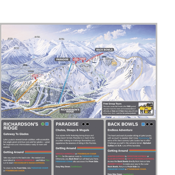
With the high elevations, ranging from around 1,600m to over 2,600m the Lake Louise piste map enjoys a relatively long season, from approximately early November through to early May – weather depending. Additionally, a vast ski range can be enjoyed by all abilities in Lake Louise, with just under 140km of groomed piste.
On the mountain itself the piste of Lake Louise is split distinct areas. Front side, that includes wide, groomed runs for predominately beginners and intermediates. West Bowl, providing long, wide, open bowls. Larch, steeper terrain and tree lined runs.
On the reverse side of the mountain, you have the Back Bowls, similar to the West Bowls, wide, open expanse to enjoy. Similar again with Paradise, wide, expansive bowls. Additionally, you have Ptarmigan, steep, tree lined runs.
Lake Louise Piste Map Download

Backside Lake Louise Ski Map PNG

Accommodation in Lake Louise
The resort of Lake Louise and base is modern. With many day lodges, ski schools and rental. However, there’s no village to speak of at the base. Which limits Lake Louise accommodation, but helps preserve the natural feel of ski resort.
You can search nearby accommodation at Lake Louise here