
Vars Ski Map
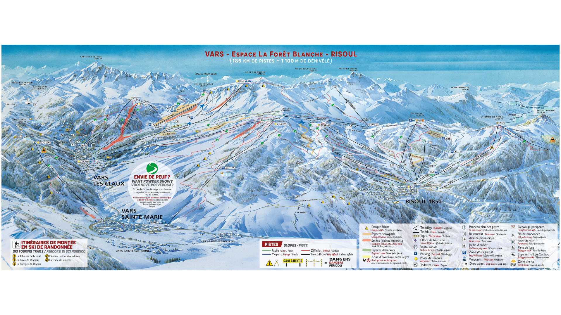
Vars ski map and resort, located in the Hautes-Alpes department of south eastern France, is a lively and scenic alpine destination that forms part of the La Forêt Blanche ski area, shared with the nearby resort of Risoul. Combined, they offer one of the largest connected ski areas in the Southern Alps, extensive terrain, sunshine, and reliable snow.
Vars sits at a approximately 1,850 metres with lifts reaching up to around 2,750 metres. Both areas of Risoul and Vars of the La Forêt Blanche area offers over 185 kilometres of ski slopes. Featuring plenty of variety, gentle, sloping greens, beginner friendly blues to more adventurous red and black runs.
One of Vars’ most famous features is the “Chabrières Speed Track”. An impressive where professional skiers attempt speed records with some exceeding 250 km/h – one of the fastest ski runs in the world.
Vars Piste Map Download
Vars Ski Map PNG

Accommodation in Vars
The large resort of Vars is made up of four mountain areas, Vars Sainte-Marie, Vars Sainte-Catherine, Vars Les Claux and Vars Saint-Marcellin. The main resort centre, Vars Les Claux, offers modern facilities, ski-in ski-out accommodation, restaurants, shops, and a lively après-ski scene.
Vars accommodation options range from comfortable hotels and apartments to chalets and family-run lodges,
Search & book here for Vars ski accommodation, or package holidays through Erna Low here.