
La Clusaz Ski Map
The La Clusaz ski map and resort is a charming and quaint ski resort in the Haute-Savoie region of France. Known for its authentic Alpine village, excellent ski terrain and relatively family-friendly atmosphere.
Convenient location and one of the best resorts that’s close to Geneva airport, being only around 1 hour from Annecy and 1.5 hours from Geneva.
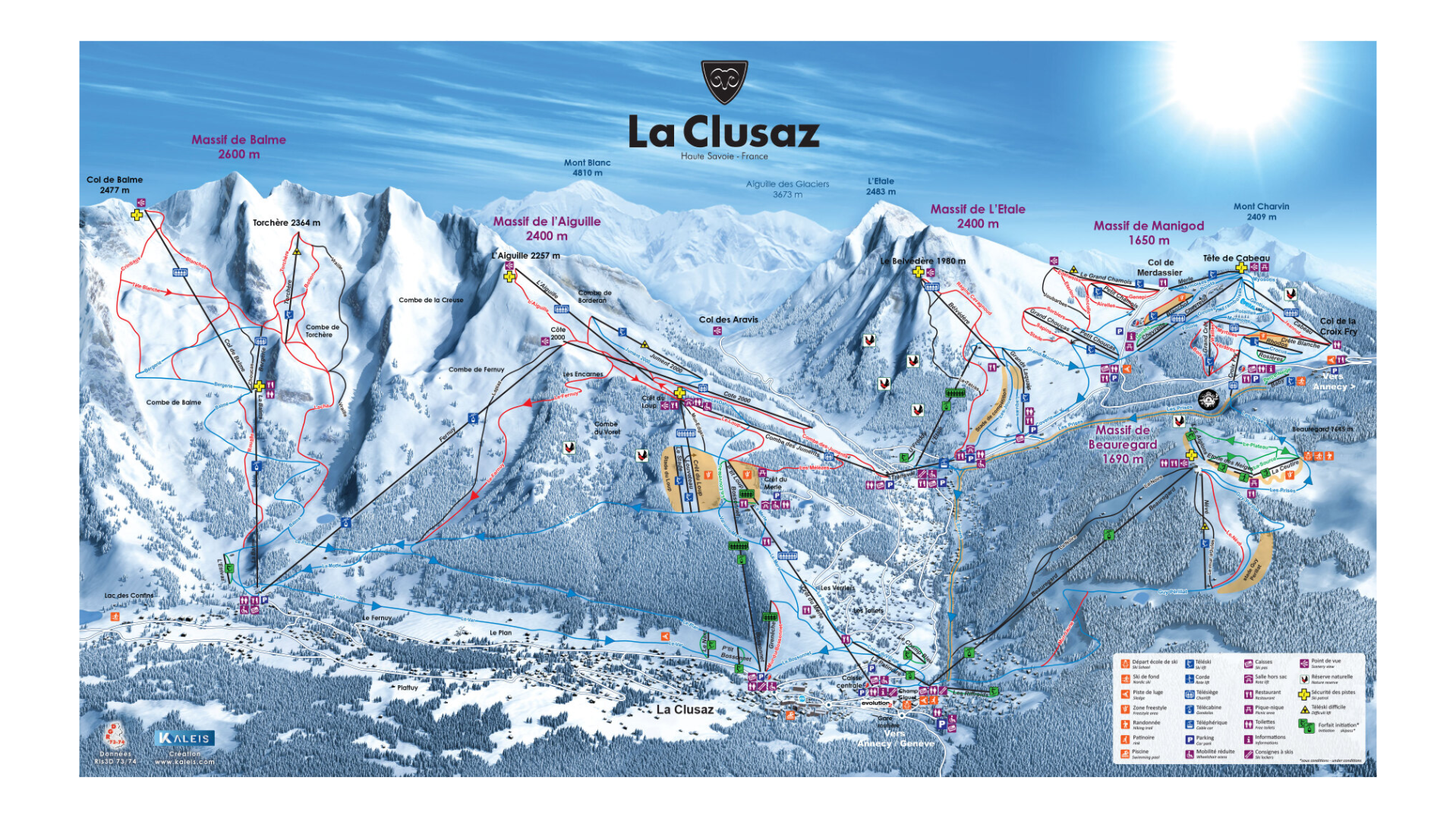
The resort heights range from around 1,000 metres to just under 2,500 metres. Modern infrastructure combined with good snowfall, especially in the higher Aravis peaks, makes for a generally good ski season at La Clusaz typically running from December to April. Additionally, the slightly higher altitude helps reliability for spring skiing and snowboarding.
La Clusaz piste map meets ability requirements of all. With many gentle beginner slopes, including green runs right near the main resort and Massif de Beauregard. Intermediates can find many red slopes, sweeping around the mid and high mountain areas. Particularly Massif de l’Aiguille and Massif de Manigod. For those more advance, off-piste is available to explore as well as a healthy amount if black runs on the piste of La Clusaz.
Other activities in La Clusaz
- Snowshoeing
- Cross-country skiing
- Ice skating
- Paragliding
- Weekly markets
- Beautiful restaurants
- Cosy cafés and bars
La Clusaz Piste Map Download

Accommodation in La Clusaz
The La Clusaz accommodation provides something for everyone. With traditional Savoyard architecture at the forefront, think wood chalets, stone buildings with warm, welcoming feels. Accommodation ranges from self catering apartments, up market chalets to boutique mountain hotels and B&Bs. Fortunately, the village of La Clusaz is compact and elevated, meaning many options are ski-in ski-out or at least very close to the slopes.
If you’re tempted, search & book here for La Clusaz ski accommodation, or packaged holidays at Erna Low here.