
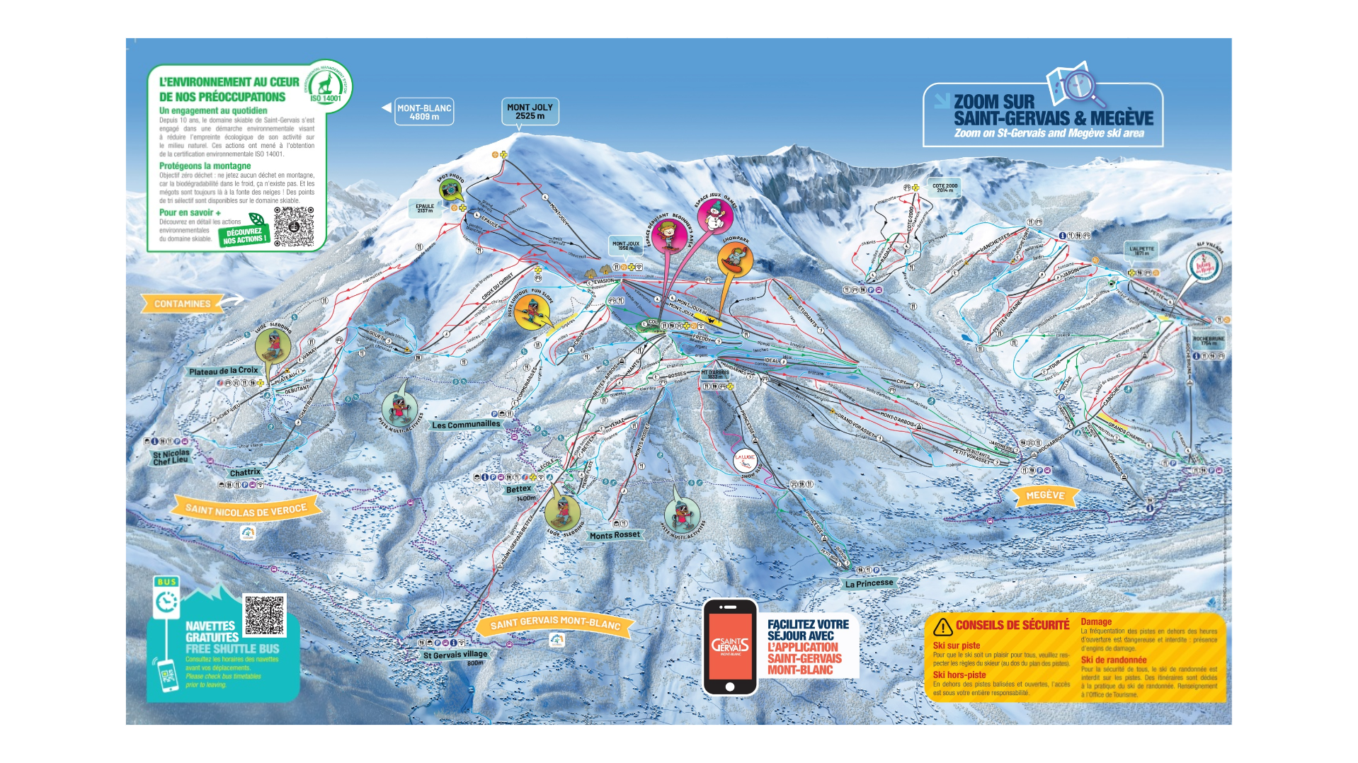
Saint Gervais Ski Map
The quieter resort of the Megeve / Saint Gervais ski map. However, similarly to it’s bigger brother Megeve, Saint Gervais is quite well connected to the local ski areas such as Les Contamines, Les Houches, the wider area of Megeve, Combloux and La Giettaz.
Free buses make the area easy to explore Saint Gervais free shuttle bus, and there’s well connected French bus system to explore the resorts further away.
Saint Gervias itself, although set at a lowly 850m provide a great base to head up to the mountain. If you’re lucky you can also ski all the way down to the base, although it’s becoming less common and you’ll need a great dump of snow.
Skiing and Snowboarding in Saint Gervais provides over 260km and more than 80 modes of transport to get you around the mountain. Elevations range from the resort base to the top of Mount Joly, 850 – 2350m. The most reliable skiing in Megeve can found at the top of Mount Joly, although there is Mount Joux and on the other side of Megeve you have Cote 2000.
For any ski hire in Saint Gervais you can head to Skiset.
Saint Gervais Piste Map Download

Accommodation in Saint Gervais
Much smaller than neighbouring Megeve, and a lot less premium. However, Saint Gervais accommodation is plentiful. Large apartment blocks provide cheaper accommodation, that’s suitable for many group sizes and families.
Alternatively, you can stay down towards Le Fayet which is conveniently connected with the new gondola lift to Saint Gervais. Or, choice to stay higher up from Saint Gervais near Le Bettex. All 3 options provide cosy chalets, or boutique hotels, such as Saint Gervais Hotel & Spa, Hôtel La Féline Blanche Saint Gervais les Bains.
Or, one of the best hotels in the world slightly further away in the Armancette.
Search & book here for Saint Gervais ski accommodation, or packaged holidays at Erna Low here.